Satellite Image Maps
NEW EDITION 2013, extensively revised
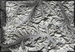
K2 and Baltoro Glacier, Satellite Image Map 1:80 000, second edition, appeared in July 2013.
The map covers the whole basin of Baltoro Glacier and the whole range of Baltoro Muztagh, east part of Panmah Muztagh and the part of Shaksgam Valley. The covered area includes also Trango Group, Gasherbrums, Broad Peak, Chogolisa, Masherbrum, Skyang Peaks, trekking summits as Pastore Pk or Sughet Ri and high treks to Ghondogoro La, Sarpo Laggo Pass or Muztagh Pass.
Main image was acquired by the satellite SPOT 4 from the height 820 km with ground resolution of 10 m per pixel. Satellite data was delivered and processed by Geosystems-Polska, all map composition made by Grzegorz Glazek.
see >>)
K2 and Baltoro Glacier, Satellite Image Map 1:80 000, second edition, appeared in July 2013.
The map covers the whole basin of Baltoro Glacier and the whole range of Baltoro Muztagh, east part of Panmah Muztagh and the part of Shaksgam Valley. The covered area includes also Trango Group, Gasherbrums, Broad Peak, Chogolisa, Masherbrum, Skyang Peaks, trekking summits as Pastore Pk or Sughet Ri and high treks to Ghondogoro La, Sarpo Laggo Pass or Muztagh Pass.
Main image was acquired by the satellite SPOT 4 from the height 820 km with ground resolution of 10 m per pixel. Satellite data was delivered and processed by Geosystems-Polska, all map composition made by Grzegorz Glazek.
2ND EDITION 2013, updated and thoroughly revised (e.g. about 60 % smaller peaks and towers added, trek trails updated).
Published by Master Topo.
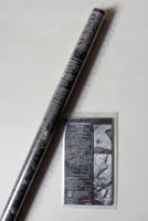
Format 99 x 68 cm (39 x 27''), available versions: folded or rolled (flat).
(For comparison side by side of both editions of the K2 & Baltoro map, see
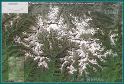
The Mount Everest, Khumbu Himal, Rolwaling Himal... Satellite Image Map 1:100 000 appeared in late fall 2004. The basics is an image acquired by the satellite Landsat 7 ETM+ from the height of ca. 830 km with ground resolution of 15/30 m, delivered and processed by Geosystems-Polska, map composition made by Jan Zurawski.
Format 130 x 89 cm (51 x 36''), rolled versions only.
Maps are available from, among others:
(for more addresses, seeWHERE TO BUY )
(for more addresses, see
- Stanfords.co.uk, Baltoro 2013, folded and flat;
- Cordee.co.uk, Everest, flat (rolled);
- MapFox.de, K2&Baltoro 2013, folded, and Everest;
- PizBuBe.ch, K2 and Baltoro and Everest (flat)
Wholesale worldwide distributor:
terra at topkart.com.pl (or contact us).
(distribution in Poland: see version in Polish)
(distribution in Poland: see version in Polish)